
The Rattlesnake Trail is among the best hike trails in Santa Barbara. The trail weaves a serpentine path across the canyon, hence the name. The recreational trail was developed in 1902 by the Santa Barbara Chamber of Commerce and became instantly popular among hikers.
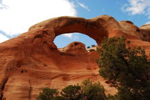
The canyon was purchased as parkland by the City of Santa Barbara in 1960. The wooden sign at the base of the canyon declare it as “Rattlesnake Canyon Wildernessâ€. The Rattlesnake Trail is popular as it is an easy trail in comparison to the other trails in Santa Barbara. It is shady and the creek usually has water around the year. The trail is well maintained and mountain bikes are not allowed on to the trail.
The trail starts at the sandstone bridge, across the Rattlesnake Creek, on the Las Canos Road. You can park your vehicle on the road or in the parking areas provided. Also, the trail is preceded by beautiful picnic grounds.
The Hike
A brief hike from the stone bridge leads to a narrow dirt road that runs parallel to the eastern side of the creek. Side trails lead to picnic spots. A dam built by the Mission padres in the early 19th century is located at the bottom of the canyon. The water was channeled into a stone aqueduct and diverted into the waterworks system of the mission. Some of the ruins are still visible to the eye of a careful observer.
Some Beautiful Sights you shouldn’t miss
The trail crosses the creek and joins a fire road, near the Monterey pine grove planted after the 1964 Coyote Fire. The fire road then leads back to the creek and the trail crosses the creek again. After this, the trail remains parallel to the creek. As the canyon narrows, the trail passes a serene pool that reflects the giant oak tree. It is the half-mile mark and is surrounded by beautiful naturalized rockroses that bloom shocking pink in season.
The More Adventurous Side
The trail takes a meandering route to the Tin Can Meadow, named after a homesteader’s shack made with kerosene can sidings and shingle, destroyed in a brush fire in 1925. The triangle meadow leads to a junction. The more energetic hikers choose to take the connector that connects the Rattlesnake trail with the Tunnel trail. The trail leads all the way to the tunnel to East Camino Ceilo. Another option is to follow the other fork and hike steep switchbacks to the Gibraltar Road.
A picturesque scene of the South Coast greets the hikers here. Here they can also see serious rock climbers ascending the Gibraltar rock. The sky has a multitude of hand gliders as the launching peak is nearby.
The round trip to the meadow and back is a 4.5-mile hike. The longer trip to the rock and back, clocks 6 miles.


